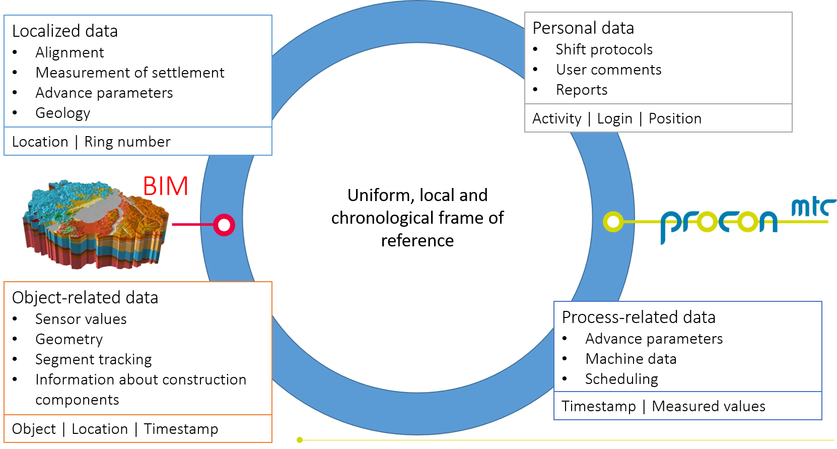
BIM can be employed at an early stage of the tunnel project and used already to advantage in the design and construction phases. The key components of these models can be linked to each other by means of a common location and time reference framework.
The tunnel model consists of the individual segmental linings representing the tunnel tubes. Each tunnel tube contains a number of rings consisting of a defined number of individual segments. Each digital segment has assigned various information from the start like its segment type or its ring number. During the tunnel advance, the information of the segments increases steadily by the incorporation of data from segment tracking and quality management, document linkage or highlighting of the TBM data history (e.g. thrust forces). An easily navigable visualization of the segmented lining allows a quick data identification, problem evaluation and overview of the projects progress.
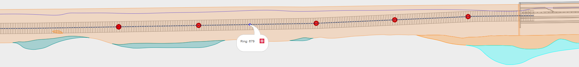
The purpose of a digital ground model is to provide information
from geotechnical investigation and geological expertise to all
project stakeholders in a computer-readable form.
Incorporating
a 3D ground model into the day-to-day project assessment provides
target-actual comparisons of ground conditions and disposal
masses, the verification of operation parameters and consumption
records as well as conservation of evidence.
The ground
model consists of numerous closed shells representing the
individual ground layers. Each layer has assigned its geological
properties. The volume of the 3D tunnel model is cut out from the
3D ground model. Along its alignment, the tunnel volume is
intersected with the digital ground model to create a digital 3D
tunnel model with areas of similar geotechnical properties.
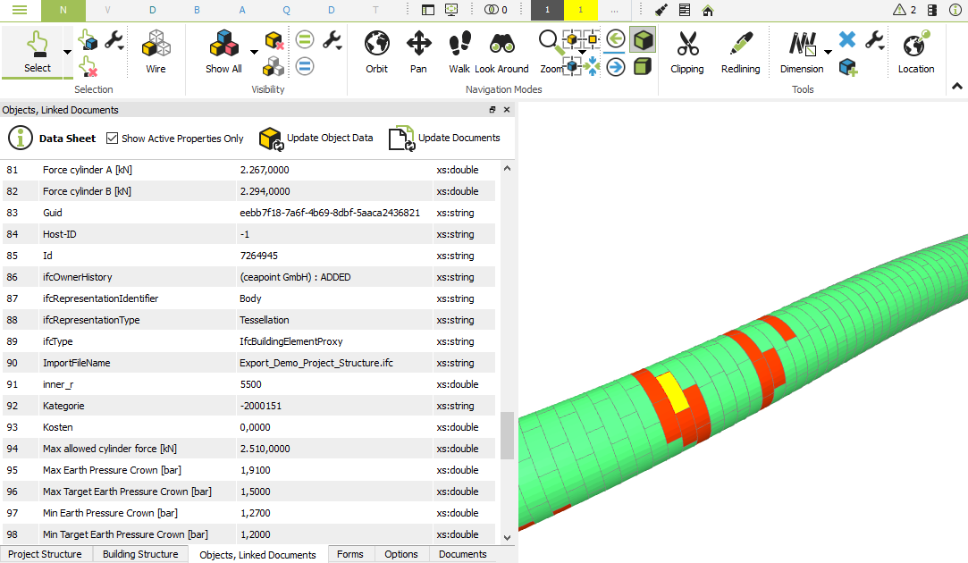
The integration of data from PROCON
or other data sources into the BIM model is implemented by
applying the DESITE MD software which contains an integrated
JavaScript API. DESITE MD is a very powerful BIM Viewer
software which can be used for BIM model evaluations like
volume evaluations or collision checks. Its Javascript API is
applied to extract data via the REST interface of PROCON and
link it with its corresponding digital representation in the
BIM model. This data can be TBM data like sensor information,
monitoring data or even document data.
Containing all
relevant information, the BIM model can be applied for the
generation of simulation models. The extraction of required
parameters for the analysis of ground/surface deformations
including TBM operation parameters enable an easy setup of
simulation models with direct comparison of predicted vs.
actual settlements.
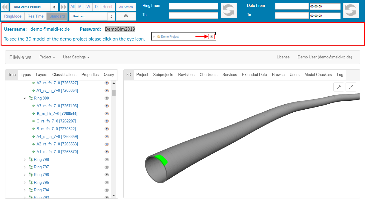
As described the management of the BIM
model is performed in the Desite MD software. However, for
data evaluation and data monitoring a simple BIM viewer can
also be applied, which visualizes the existing models and
displays the linked information. Therefore, PROCON has
integrated a web-based BIM viewer in which the current BIM
model of the demo project has been uploaded. Evaluations on the BIM model can also be performed here. Thus, the BIM
model is also made available to PROCON users who do not have a
Desite MD license.
To visualize the 3D BIM model, click on the eye behind the project name.